After leaving Toronto, our next destination was Seattle, Washington which, according to Google, was some 2700 miles and an estimated 39 hours driving time. We stopped for gas, food, and sleep, but not much else. The exception to this rule (after all, there must be an exception to the rule) was in South Dakota where we drove a little way off course to go through the Badlands, and a little farther on, to see Mount Rushmore. Most of the pictures everywhere else were taken from the car (by the passenger!) as we were going 80 mph, so please excuse any fuzziness.
Day 1 -Toronto to Chicago, Il
August 9, 2023
Since it was a weekday, Mays worked for about 4 hours in the morning and then we started out about 10:30 Eastern time from Toronto, crossing from Canada into Michigan just northeast of Detroit. We continued west across Michigan and then southwest to skirt the bottom of Lake Michigan, going through a teeny bit of northwest Indiana before crossing into Illinois and through Chicago. Throughout the day we only stopped for food and gas, but because the traffic between Toronto and Michigan was pretty heavy, our estimated 8 hours to Chicago turned into 10 hours.
St. Clair River, Ontario, CA
Stop sign on Walpole Island First Nation at the ferry crossing to Michigan
Heading by ferry to the U.S. border patrol station
Crossing St. Clair River between Walpole Island, Ontario and Algonac, Michigan
We crossed into the Central time zone as we watched the sunset around Gary, Indiana heading toward Chicago
Chicago skyline at night
The hotel just west of Chicago was basic, but the bed was comfy, which was all that was needed
Day 2 - Chicago, Il to sioux falls, sd
August 10, 2023
After a good night’s sleep, and a few hours of work for Mays in the morning, we hit the road around 9am Central Time and continued northwest through Illinois into Wisconsin, then west to Minnesota. The land was fairly flat through Wisconsin, but as soon as we crossed the Mississippi River the terrain became very hilly before flattening out again in western Minnesota and into South Dakota. Fun fact: the Mississippi River is only 50 feet across at La Crosse, Wisconsin compared to a mile across at St. Louis, Missouri. This day was an easier drive – only eight hours, and so we had time to see a few local sites before having dinner and settling in for the night.
Driving through southern Wisconsin
Eastern Minnesota - very hilly terrain
Very straight roads in western Minnesota
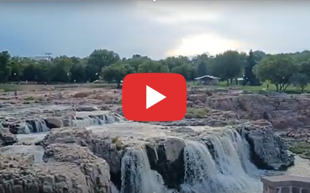
The falls at Sioux Falls
Western Wisconsin
Western Minnesota - flat land again
We crossed into South Dakota at 4:30pm
The falls at Sioux Falls
Crossing the Mississippi River from Wisconsin into Minnesota - only 50 feet wide at this point
Wind turbine field in Minnesota - they stretched as far as we could see
The park surrounding the falls at Sioux Falls
Copy of the statue of David in downtown Sioux Falls
Crossing into Minnesota
Minnesota cows
Ruins of the Queen Bee flour mill (7 stories when in operation) at Sioux Falls, SD
Sunset in Sioux Falls, SD
Day 3 - Sioux falls, sd to bowman, Nd
August 11, 2023
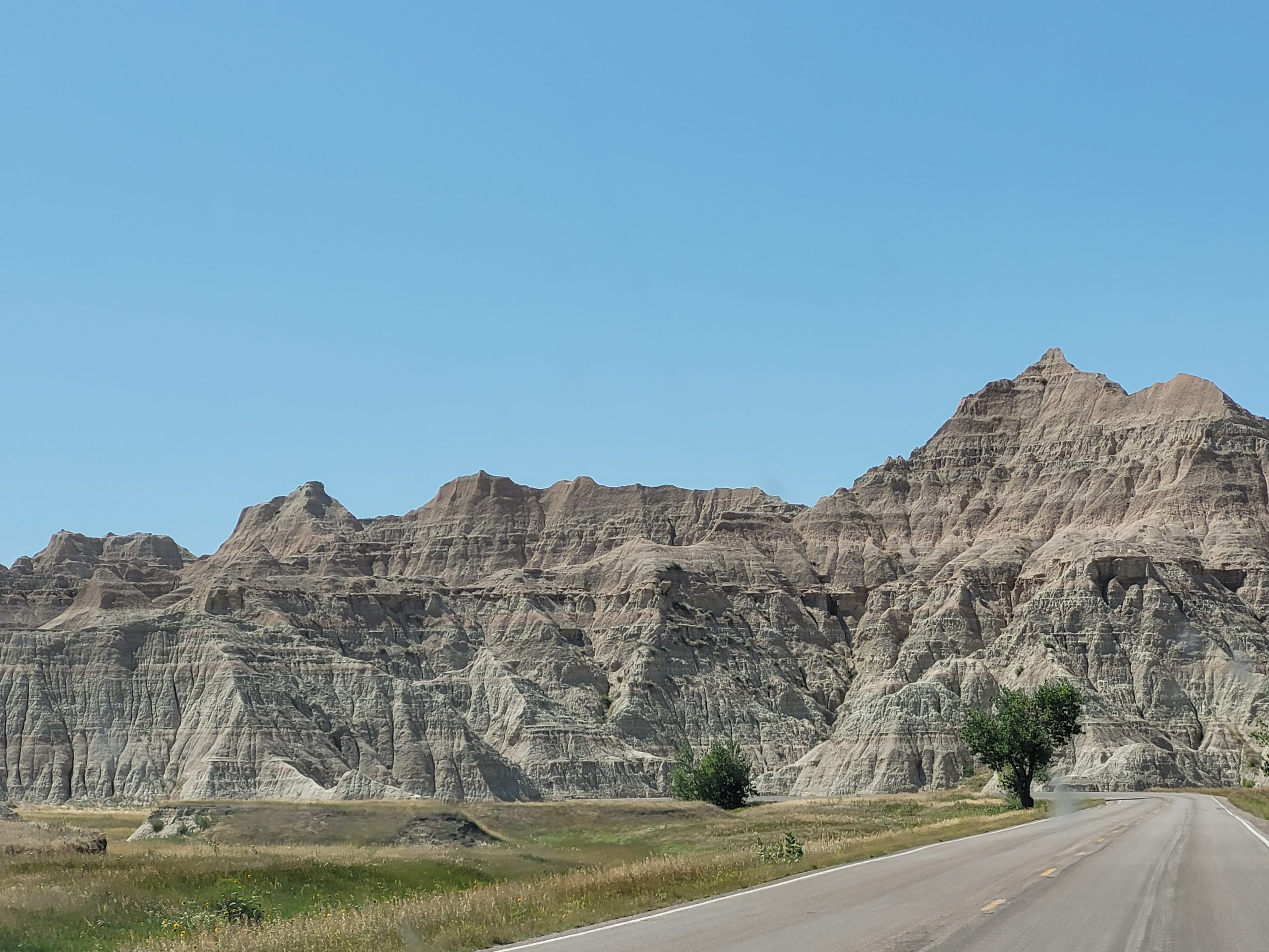
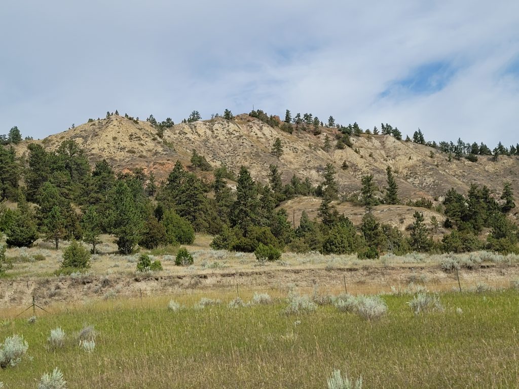
We got on the road at 10am; we were expecting to drive about 7.5 hours this day to Bowman, North Dakota, but since we also factored in an extra few hours to visit the Badlands and Mount Rushmore along the way, we knew it was going to be another long day. After driving 3.5 hours through completely flat prarie, we crossed into the Mountain Time Zone and reached the Badlands a half hour later, and they did not disappoint. The incredible formations are on either side of a valley featuring a slowly eroding “wall” on the north side that separates the northern upper prairie from the lower prairie to the south. The structures were magnificent; pictures cannot capture the beauty of them. The only disappointing thing was the constant sound of motorcycles interrupting the stillness as they traveled the route through the park.
After a late lunch at Wall Drug, which has grown into a multitude of attractions and turned the small town of Wall (named after the Badlands Wall) into a local tourist mecca, we continued on to Mount Rushmore, reaching the site in the Black Hills around 5:30pm Mountain Time (the number of motorcycles surrounding us on the road increasing all the time). The carvings were smaller than one is led to believe from pictures and television, but still impressive. There is a small amphitheater at the foot of Mt. Rushmore, and we stayed a little while to enjoy music by a few choruses, but there were still miles to go before we slept, so we soon continued on north to North Dakota. Along the way, we found the source of the motorcycles; apparently we were traveling through the area at the exact time of the Sturgis motorcycle annual rally! After passing through Sturgis, we quickly, and thankfully, left the motorcycles behind and continued on through completely deserted terrain lit by the setting sun to North Dakota and the only hotel within 50 miles.
Clouds over South Dakota
Somewhere in South Dakota
The Badlands
The Badlands
Chainsaw art: World's largest jackalope sculpture, Wall, SD
Somewhere between Wall and Rapid City, SD
Motorcycles everywhere on the way to Mt. Rushmore
Heading north through South Dakota
It's very flat here
Approaching the Badlands - all of a sudden, it's less flat
The Badlands
Lower prarie of the Badlands
Wall Drug has expanded since its founding in 1931 when they offered free ice water to passing travelers
In front of the Avenue of Flags with Mt. Rushmore behind
Dinner at the No. 3 Saloon in Buffalo, SD at 8:30pm. We were afraid to wait to get to Bowman, that nothing would be open
Did I mention that it's flat?
Panoramic shot of the Badlands
Driving through the Badlands
The Badlands
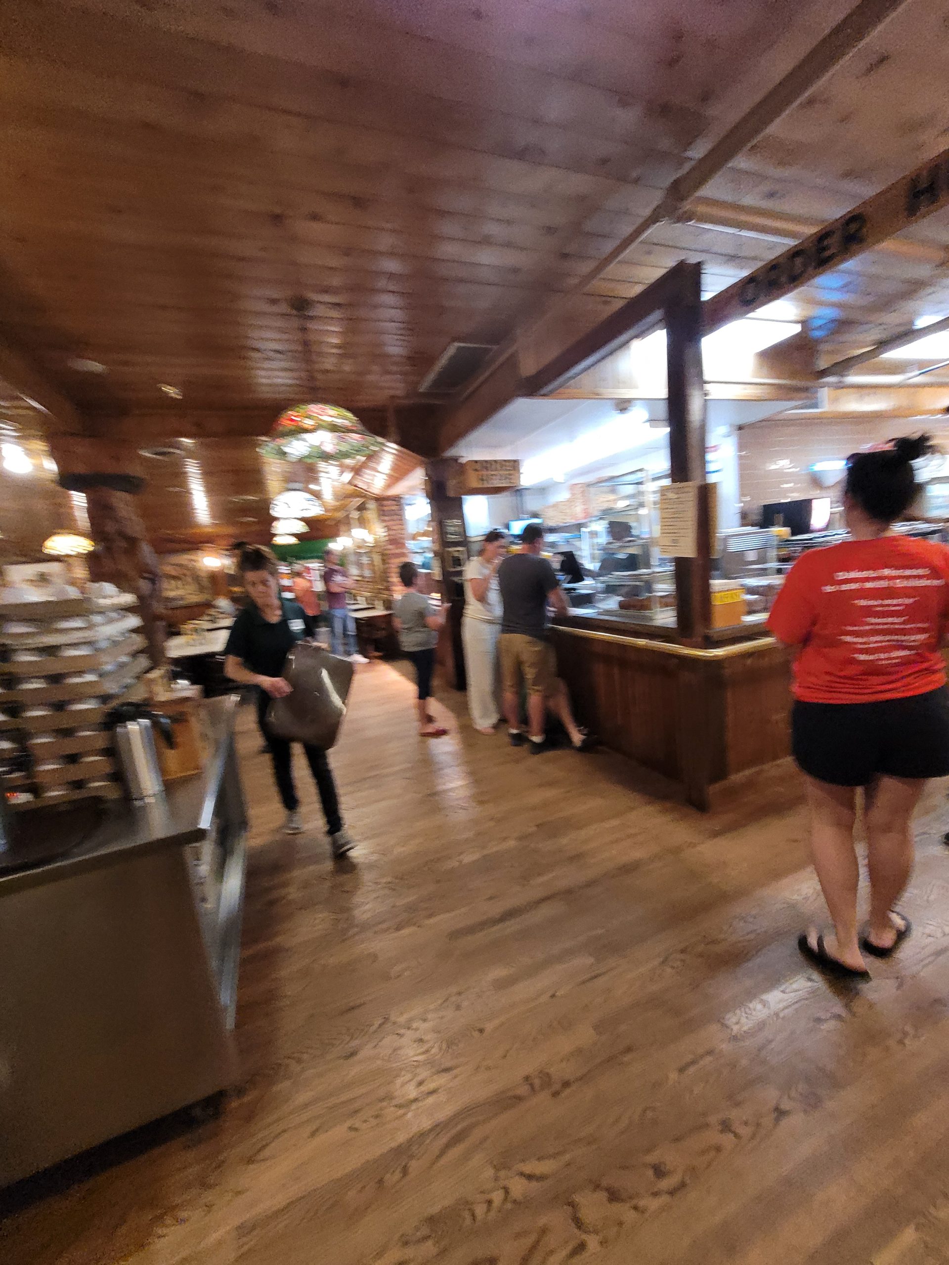
Inside Wall Drug Store, which is now a mall that includes a restaurant, bookstore, jewelry store, clothing store, and chapel
Mt. Rushmore
Music at Mt. Rushmore National Park
Motorcyle rally camp at Sturgis, SD
HUGE wind turbines
View from Big Badlands Overlook
The Badlands
The Badlands wall from the lower prairie
Wall Drug Store restaurant
Avenue of Flags, that has the flag and statehood information for all 50 states
Motorcyle rally camp at Sturgis, SD
Missouri River
View of the wall
The Badlands
Western humor
Wall Drug Store
Music at Mt. Rushmore National Park
Music at Mt. Rushmore National Park (includes a shot of Mt. Rushmore)
Sun setting in South Dakota
Day 4 -Bowman, Nd to spokane, wa
August 12, 2023
It was Saturday, so no work for Mays! We could get an early start at 8am Mountain Time which turned out great. Although we originally were aiming for Butte, Montana as our stopping point, it was only 3pm when we got there and we weren’t tired yet. So we kept going to the next town large enough to have a hotel, which turned out to be Spokane, Washington, another five hours away. We stopped about every two hours though to keep the gas tank filled up. Although South Dakota had fuel stops in between towns (exits that were very little more than a gas station), we hadn’t seen any since heading north from Rapid City, SD and we really didn’t want to take any chances getting stuck, as the temperature was pushing 90 that afternoon.
Follow our progress across North Dakota, Montanta, Idaho, and and Spokane in the pictures below, left to right.
Downtown Bowman
North Dakota
Montana
Montana
Montana
Clark Fork, Montana
This is the feeling of falling down a mountain! (Idaho)
Started to fight the setting sun as we continued west
Hay bales, North Dakota
Marmarth, North Dakota
Montana cows
Montana
Montana
Fuel and coffee stop in Missoula, Montana
Idaho
Cougar Bay, ID
Sunflower fields, North Dakota
Montana. Back to absolutely flat land
Montana. Starting to see some hills
Lunch and fuel stop in Billings, Montana
Montana
Montana
Idaho
Idaho
Sunflower fields, North Dakota
Montana
Fuel stop, Miles City, Montana
Montana
Montana
After 10 hours on the road, we finally reached Idaho and crossed into Pacific Time
Idaho
It's a blurry shot, but it was a welcome sight! (Washington)
North Dakota
Baker, Montana
Montana
Montana
We followed alongside Clark Fork in a Montana valley for about a half hour.
Idaho
More falling down the mountain (Idaho)
Sunset over Spokane, Washington
Day 5 -Spokane,Wa to seattle, wa
August 13, 2023
The final day was an easy one since we drove so far the day before. Before leaving Spokane, we drove downtown to see the Spokane Falls. Due to the lack of rain this summer, they weren’t falling so much but still very pretty and serene. This would be a great place to have coffee on a weekend morning and enjoy the peaceful scene.
After enjoying the falls, we continued west through some very arid terrain. Apparently the Cascade Mountains to the west block a lot of the weather systems that come across from the Pacific, so the west side of those mountains get all the rain and the eastern side hardly any.
Eastern Washington
Columbia River looking north
Just east of Ellensburg, we could see Mt. Ranier in the distance
Driving through the Cascades
Eastern Washington
We didn't find any thankfully
Washington wind turbine field
Driving through the Cascades
Moses Lake, Central Washington
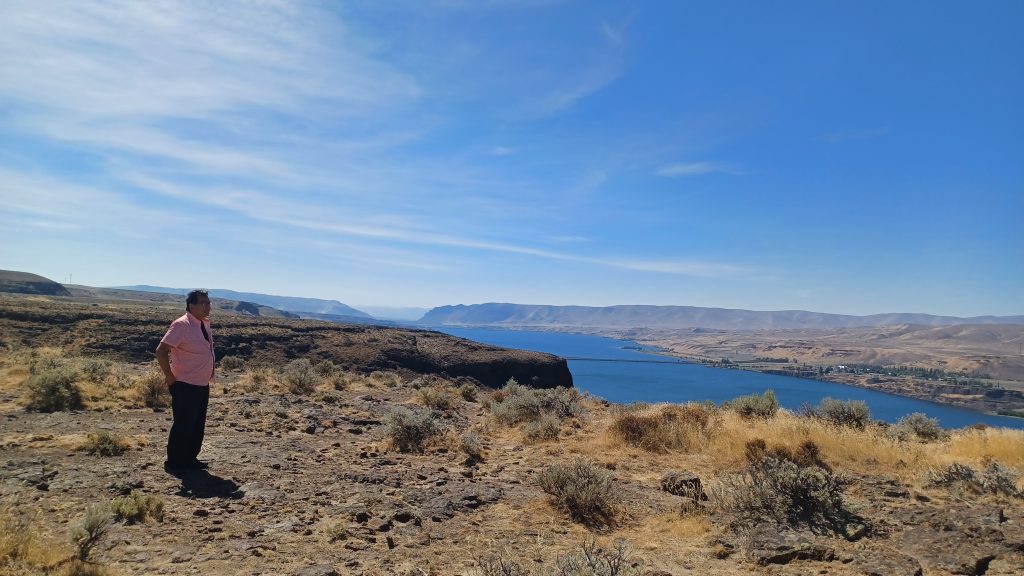
Columbia River looking south, Vantage Bridge in the distance
At Perkins Restaurant for lunch in Ellensburg. The blueberry pancakes were stupid good!
Driving through the Cascades
Columbia River looking south
Columbia River from Vantage Bridge
Entering the Cascade Mountains
Driving through the Cascades
We're here!
We didn’t think to take a picture as we came into Seattle, but at 3:15pm we reached Mays’ sister’s house in Kent to the south of the city. Check out our Seattle page to continue following our adventures there!
3 Responses
PK6game is awesome, really enjoying the gameplay. So many things to discover! Join us and have fun with: pk6game


3 Responses
PK6game is awesome, really enjoying the gameplay. So many things to discover! Join us and have fun with: pk6game
Heard some whispers about 345egame. Anyone playing it? What’s the verdict? Worth my time? Let me know in the comments! See for yourself 345egame
Hey all! Has anyone tried downloading from 666dgamedownload.com? Looking for the 666dgamedownload and want to make sure its safe. 666dgamedownload